Hello travelers! Today I’d like to write about a very interesting topic and I’ll try to resolve some questions about the volcano. ¿Can you climb the Popocatepetl? ¿Is it safe to walk in Popo? I hope you like it!
Want to hike near Popocatépetl? Climbing Popocatépetl is currently not allowed due to volcanic activity. You can still enjoy the scenery safely on the Iztaccíhuatl Volcano Hiking Tour—the neighboring dormant volcano with panoramic views of Popocatépetl’s crater.
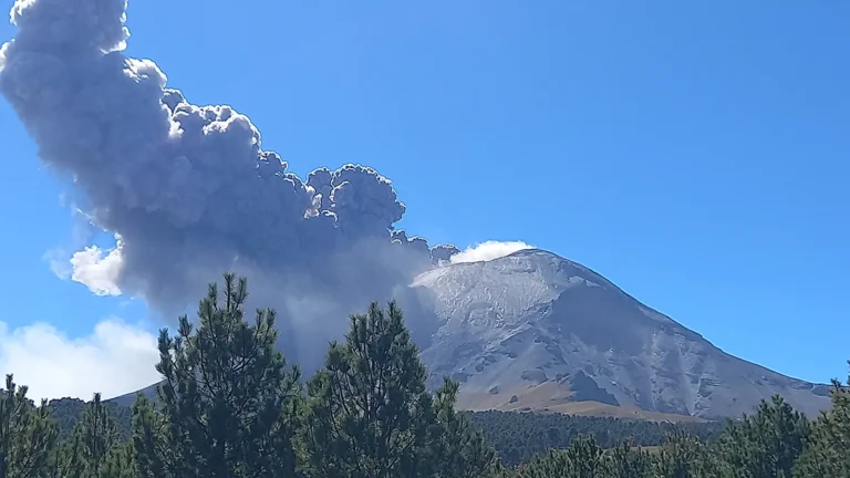
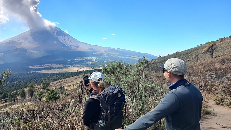
Popocatépetl erupts (February, 2024)
The Izta-Popo National Park contains two volcanoes in the same Protected Natural Area: Iztaccíhuatl and Popocatépetl. Both can be admired from within the park, where hikers explore trails with breathtaking views.
Iztaccíhuatl is an inactive volcano and is safe to climb to the summit, or you can hike specific trails to admire the beauty of both volcanoes. On the other hand, Popocatépetl is an active volcano and is not possible to climb to the top, or walk close to the crater.
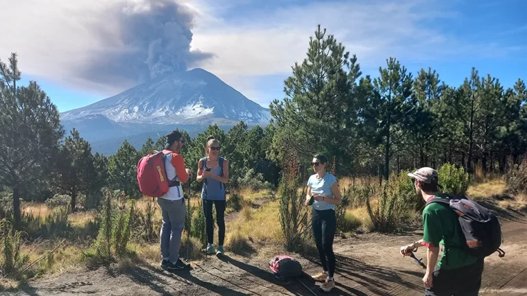
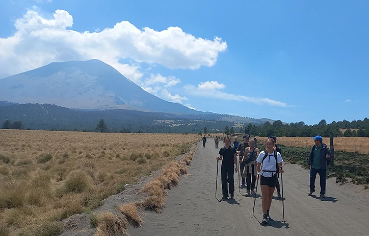
Hiking Tour in Izta Popo National Park (February, 2024)
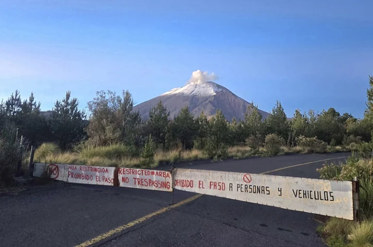
POPOCATÉPETL DANGER ZONE
The Popocatépetl volcano is the second highest volcano in Mexico (5,400 masl/ 17,716.5 ft), in English it means “Smoking Mountain” because is an active volcano since 1994 and is monitored 24 hours every day by the government of Mexico (CENAPRED).
The Popocatépetl’s danger zone is 12 km (7.45 miles) radius around the crater. This exclusion area is restricted and is not possible to walk through due to the ash, smoke and rocks.
The guards and the mountain police ensure that people do not run the risk of walking in this area.
Popocatépetl's Danger Zone (June, 2024)
Beyond this restriction area it’s possible to walk. However, there are safe hiking alternatives near Popocatépetl (Iztaccíhuatl National Park)
Hiking Trail "Level 1" Between Two Volcanoes (November, 2023)
The probabilities that a really big eruption occurs and exceed 12km are very low, and if that happen Mexico City or Puebla will not be affected, only ash would arrive. If you would like to read more about this subject you can take a look in the government’s website and check the maps.
POPOCATÉPETL HIKE
Now that we know the restricted area around the volcano is 12km, we can safely enjoy hiking activities beyond this zone with breathtaking views. Here are some options:
Level 1 “Alpine Trail” Walk between the two volcanoes on this 8-9 km route and reach a beautiful viewpoint.
Level 2 “Spring water Trail” Take a longer hike between the two volcanoes and visit a natural waterfall and the spring waters on this 13 km trail.
Level 3 “Portillos Trail” Hike on Iztaccíhuatl with views of Popo at higher altitudes.
Level 4 “Iztaccíhuatl Summit” Enjoy the big challenge of reaching the peak of this inactive volcano.
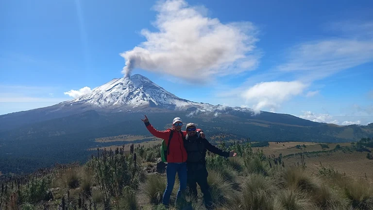
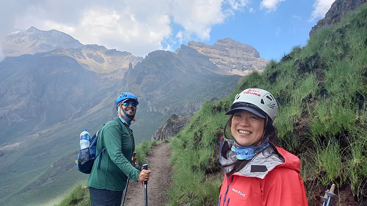
Hiking Tour in the Volcanoes "Level 3" (May, 2024)
Izta Popo National Park
Hiking or Trekking in the Iztaccihuatl Popocatépetl National Park is allowed and not dangerous if the activity indicator is in “yellow phase 2”, this means that the park is open to all visitors.
The government has designed a volcanic activity indicator to let people know how active the volcano is. It’s like the traffic lights: green, yellow and red.
Green means that the volcano is quiet
Yellow means that is active (since 1994) but it’s still possible to hike
Red means danger, the National Park is closed and there’s an evacuation for people living near the crater (Xalitzintla 12km and San Pedro Benito Juárez)
The Popo had a period of 70 years of inactivity and it may take many years to be inactive again. Since 1994 it’s been in yellow phase 2, I mean it’s a volcano that almost every day has eruptions.
Group of Tourist in Itza Popo National Park (March, 2024)
For us hikers, it’s possible to visit the volcanoes while the activity indicator is yellow phase 2 or below. It’s been in this stage since 1994 and the National Park is open for hiking, trekking or mountaineering and there’s no problem. You can check the color in the government website.
When the indicator is in red it means that the park is closed and people who live near the Popocatepetl have to evacuate since they are located near the crater.
According to the government’s risk map, Mexico City and Puebla City would not be at risk if a big eruption happens.
POPOCATÉPETL LAST ERUPTION
The last time Popocatépetl erupted was on December 12, 2000. The volcano increased its activity and 41,000 people had to evacuate because they were living near the crater. Some people moved with family or friends, and others moved to shelters.
“Popocatépetl’s Video Last Eruption (December, 2000)”
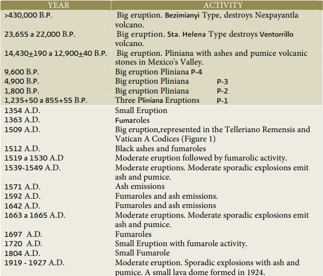
PERIODS OF ACTIVITY AND INACTIVITY
For more than 400,000 years the volcano has had small, moderate and big eruptions as you can see in the next timeline:
“Historia de la Actividad del Volcán Popocatepetl 17 años de erupciones” by Centro Nacional de Prevención de Desastres and UNAM. Available in: https://www.cenapred.unam.mx/es/Publicaciones/archivos/225-HISTORIADELAACTIVIDADDELVOLCNPOPOCATPETL-17AOSDEERUPCIONES.PDF
Mapa de Peligros del Volcán by CENAPRED. Available in: https://www.cenapred.unam.mx/es/Publicaciones/archivos/357-CARTELMAPASDEPELIGROSDELVOLCNPOPOCATPETL.PDF
Semaforo de Alerta Volcánica by the Government of Mexico. Available in: https://www.gob.mx/cenapred/articulos/semaforo-de-alerta-volcanica-220744